Had a chance to visit Taiwan again in last November. It was an invitation to attend a symposium in Taichung. So I decided to take a few days to explore Taipei before the conference. But this round I opted for hiking experience. Thus, the search for easy access of hiking venues around Taipei city. One particular blog has provided most of the useful information for my trip: www.nickkembel.com.
I picked Qixingshan trail in Yangmingshan National Park as my first choice for the hiking. It's easily accessible with moderate difficulty level of the hiking route. To get to Yangmingshan, one can opt for the public transport right below Jiantan MRT station. The Taipei Performing Arts Center is just opposite the bus stop areas. I took the S15 mini bus which is bound for Lengshuikeng. Waited a few minutes, the bus came. There were many locals heading to the national park on that day. So I had to stand for almost the entire journey.
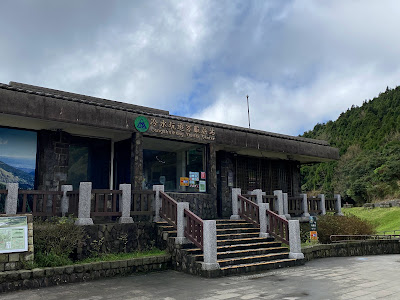
Got off at Lengshuikeng Visitor Center (which is the last two stop). From there, walked across the road and headed to the trail of Qixingshan trail. It's a 5-minute walk. And one will start his staircase climb from the entrance, all the way to the peak. It took me 4 hours plus to hike to the peak and down to the other side. There are 2 peaks which can be easily reached, i.e Qixing East and Qixing Main Peak. I added another peak which is off the beaten track (Qixing South - not recommended due to difficult trail). I also made a detour to Menghuan Lake. The lake was calm. Nothing spectacular.
Got off at Lengshuikeng Visitor Center (which is the last two stop). From there, walked across the road and headed to the trail of Qixingshan trail. It's a 5-minute walk. And one will start his staircase climb from the entrance, all the way to the peak. It took me 4 hours plus to hike to the peak and down to the other side. There are 2 peaks which can be easily reached, i.e Qixing East and Qixing Main Peak. I added another peak which is off the beaten track (Qixing South - not recommended due to difficult trail). I also made a detour to Menghuan Lake. The lake was calm. Nothing spectacular.
Going down hill from the peak, one can opt for the Xiaoyoukeng route. There's another visitor center there. You will pass by few steaming fumaroles along the way. At the center, either take the same bus back to the MRT station or the more frequent bus to the park's headquarter. From there, take another bus to the town or MRT station. Overall hiking experience was great.


Comments